Zoom
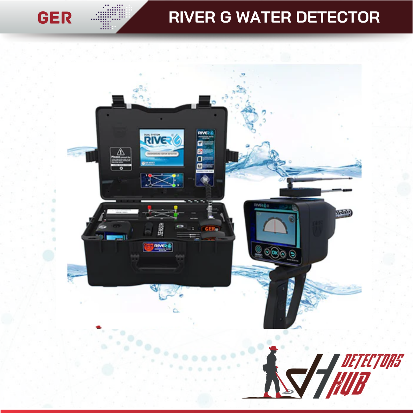
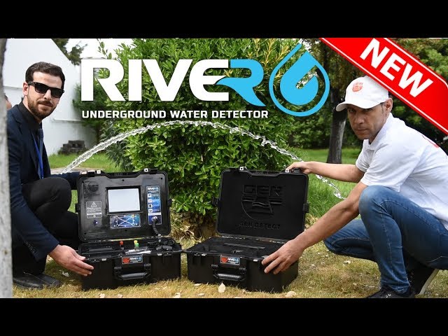
A completely new device and one of its kind worldwide, the River G, is distinguished by three systems for the detection of groundwater, artesian wells, and boreholes within the ground.
With the flexibility to spot the water depth underground, the device reaches a depth of 1500 meters inside the soil and up to 3000 square meters from the front range.
We congratulate ourselves, farmers, agricultural land investors, researchers, explorers, and major water exploration companies, for issuing a completely new and one-of-a-kind global device and dealing with
three subterranean water exploration systems.
The system reaches a ground depth of 1500 meters and a front depth of up to 3000 square meters.
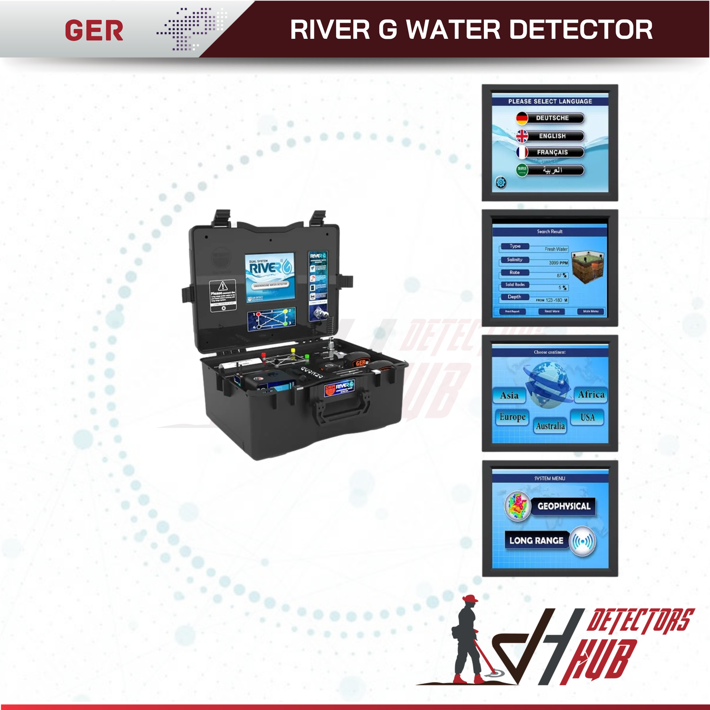
Very accurate and high possibility to determine the type of water, whether it is or not (fresh - salty - very salty).
The option of choosing the continent and thus the country to be checked for underground water is one of the unique features.
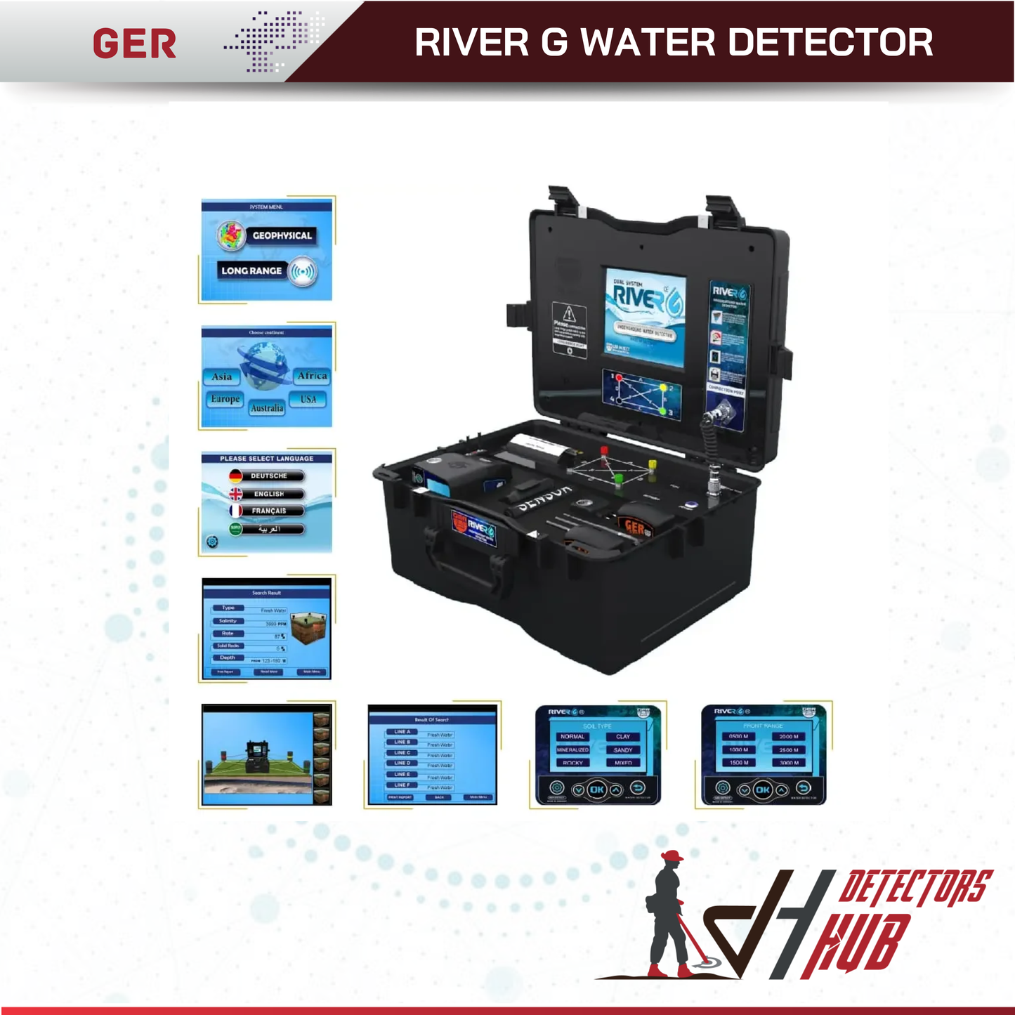
The opportunity to discover the world and different terrain everywhere with the chance to search for six different types of soil (rocky - natural - mixed - mineralized - clay- sandy) and show the proportion of rocks within the soil scanning field.
A high-quality three-dimensional image inside the water search area of the placement of water and rocks.
Even, with the ability to assess underground water depth.
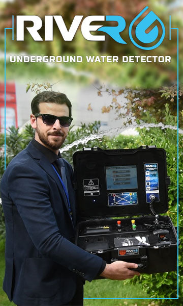
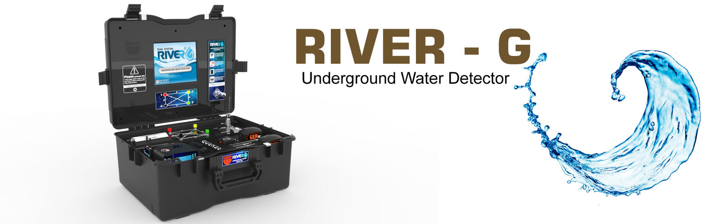
RIVER G is a new technology for detecting and locating under-ground water sources.
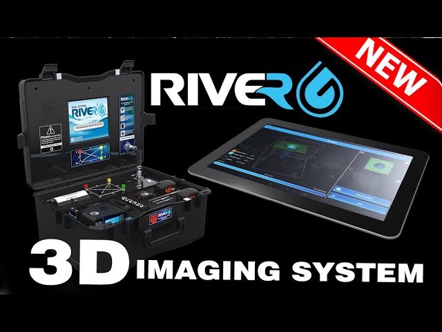
First system: 3D IMAGING SYSTEM
In addition, a 3D imaging device is provided with the RIVER G Water Detector to enable the prospector to determine more detailed information of the existence of underground water layers as a three-dimensional image to display a number of results from the water study.
Water type with a symbol that means the easiest place to dig, containing the most significant amount of water.
The detected water depth is determined by meters. A graph showing the density and salinity ratio of rocks.
Second system: GEOPHYSICAL SEARCH SYSTEM
The Geophysical Method in the River G system is one of the most versatile and effective water-searching systems and is also the most precise and fastest to achieve results.
With several special features, this device provides the prospector with all the knowledge he wants about underground water.
Determination of the underground water depth as precise information of the density, salinity and form of water, if it is (fresh - salty - very salty).
Third system: LONG RANGE SYSTEM
In large areas, this highly precise method and excellence decides the location of water.
There are many features of the long-range machine device:
High-resolution display of colors with a touch option.
Works with keypad and touch.
Provides six separate languages: (German - English - French - Spanish - Italian - Arabic).
Digital compass to figure out the direction of the search.
Determine the type of soil that is consistent with the nature of the search location (rocky - natural - mixed - mineralized - clay- sandy).
When the target is captured, the user also switches to the discovered target before the target is fully raised,
Confined to an area of 1 square meter and with the power to work out the front range of the unit, with a depth of 500 meters or 1000 or 1500 or 2000 or 2500 or 3000 meters, 1500 meters underground.
When the computer is working, one of the languages is selected, the front range determined
The system heads to the detected target when capturing the target, the user often walks up to achieve the target and is completely confined to the square meter area.
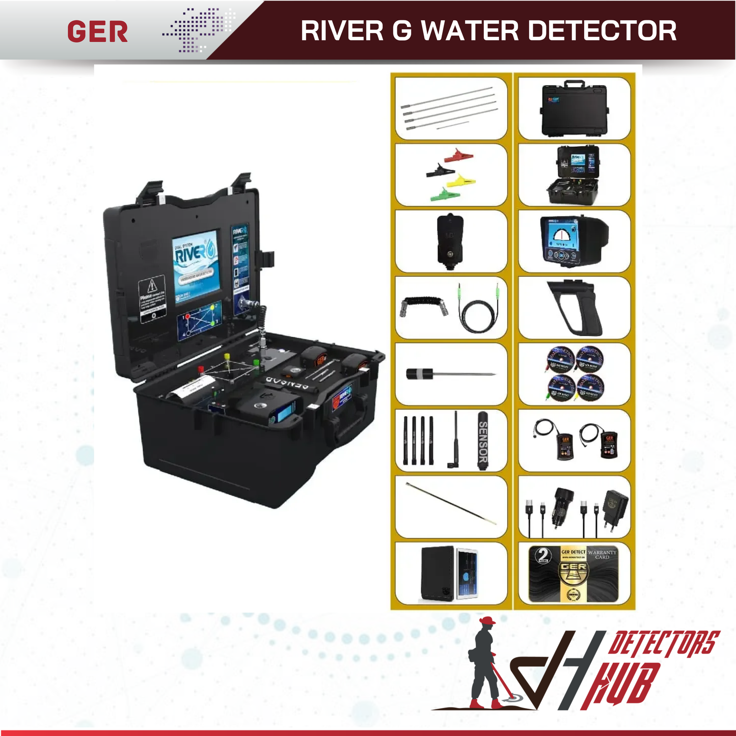
Technical specifications of RIVER G device
Three single-device search systems.
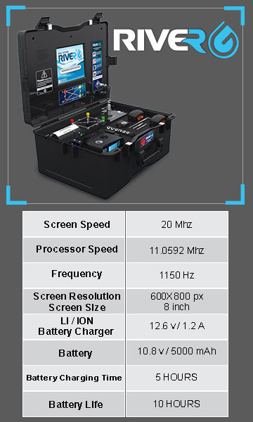
High resolution, wide 8-inch screen with a touch option.
A tablet for a 3D imaging device that displays a three-dimensional image of the water locations and the distribution of rocks in the search area using the Android system.
High velocity and precision in search data processing.
A portable printer with a main device that prints an instant summary of the results of the method of detecting water underground.
A 4.3-inch high-resolution color screen and a touch option for a long-range setup.
Works with keypad and touch screen.
Provides six separate languages: (German - English - French - Spanish - Italian - Arabic).
The probability of the continent and the countries within it being selected.
Digital compass to decide the direction of the search.
The possibility of evaluating the underground water depth.
The device's depth exceeds 1500 meters.
With the possibility of deciding the appropriate front range, the front range is up to 3000 meters.
Determine the soil type according to the design of the area to be searched (rock - natural - mixed - metal - clay-sand).
Origin and warranty certificate for two years from the date of purchase.
The weight is (9 kg) only for the system bag.
The weight for bag accessories is (7 kg) only.
The system worked all over the world and on various terrains.
With European cε certification according to international standards, the RIVER G system is one of the best German innovations.
Downloads
User Manual
Wishlist is empty.


