Zoom
Overview:
Ground radar that is portable
On-site 2D analysis
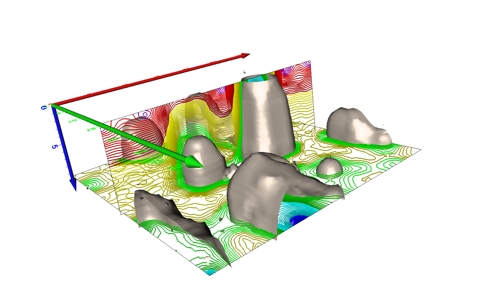
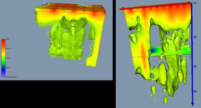
On-site 3D analysis
Simple to operate
USB interface powered by a battery
At any temperature, it is ready for use.
Location up to 40m deep
With KS Analysis, you may immerse yourself in the captivating world of soil Exploration! We are excited to provide cutting-edge technology that will allow you to explore the ground beneath your projects with remarkable accuracy. Our ground penetrating radar gives you the capabilities to unearth buried secrets, whether you're in the construction sector, wanting to make archaeological discoveries, or doing environmental research.
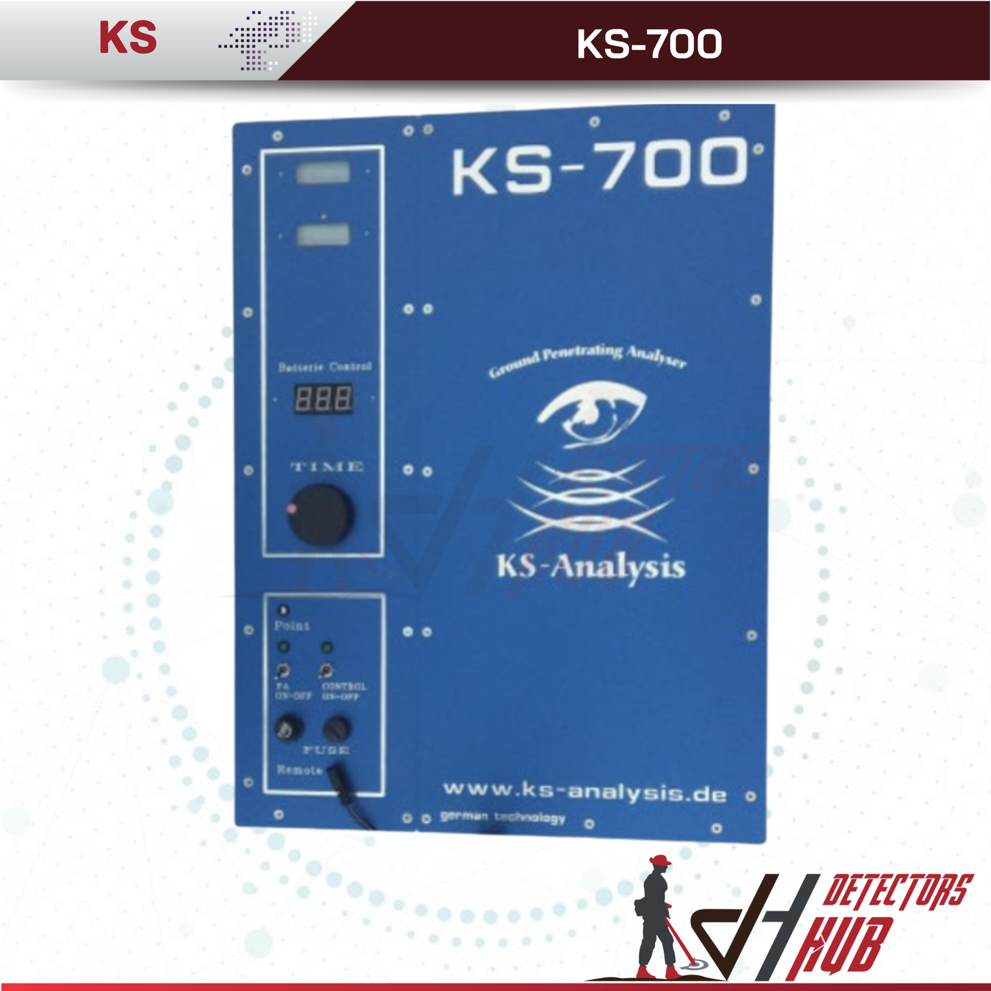
The KS700 was designed to identify cavities.
It is a ground radar that operates on the "FMCW radar" principle.
The ground radar can detect objects in the solid rock body from 0 to 40 meters away.
We have discovered tunnels from WWII in limestone up to 60 meters long, however keep in mind that these tunnels are approximately 5 meters broad and 7 meters tall.
THE KS700 GROUND RADAR CONTENTS:
AREAS OF APPLICATION

Metal detecting is used in archeology.
Examining areas of contamination Underground sounding for building projects, particularly cables, pipes, and shafts
Elimination of risk in the event of secondary mining damage and sinkholes
Localization of old underground rooms, adits, tunnels, and passages, among other things.
It's not essential to switch out the antenna with this FMCW ground radar for varied depth ranges!
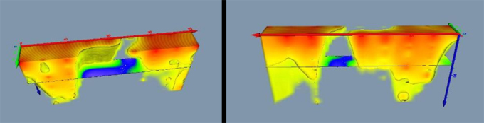
Images of software and measurements radar on the ground
The software allows for the instant display of the measuring image.
The measurement profiles are displayed in two dimensions, allowing the user to immediately adopt the measurement profile.
Our references have opinions on this.

Software
The package includes 2D software. The data can be transported in 3D software (3D Data Visualization Solution) using the "Import-Export" function, such as "Voxler" by Golden Surfer (not included).
The package includes 2D software. The data can be transported in 3D software (3D Data Visualization Solution) using the "Import-Export" function, such as "Voxler" by Golden Surfer (not included).
Napoleon Cemetery

Ground penetrating radar KS-700: explanation of prior radiometric and geophysical investigations
Wishlist is empty.

